• MONITORING
  • MAPPING
    • Home
    • About
      • About Us
      • Our Team
      • News & Views
      • Events
      • Sustainability and the Environment
      • Case Studies
      • Careers
      • Contact Us
    • Industries
      • Ports and Harbours
      • Maritime Pilotage
      • Bridges and Inland Waterways
      • Offshore Renewables
      • Governments and Agencies
      • Case Studies
    • Compliance
      • Compliance Overview
      • Marine Data Management
      • Asset Management System
      • Spatial Data Management & GIS
      • Our Courses
    • Training
      • Our Courses
      • Data Management
      • Data Management for Ports
      • Data Management, Governance and MEDIN toolset
      • Data Management and Marine Spatial Data Infrastructure (SDI)
      • Technical Training
    • Partners
      • Licenced Partners
      • Partner’s Resource Hub
    • Support
      • Resources
      • Support
      • Contact Us
banner

The birthplace of the UK’s Sea Level

By Katie Edies 3rd February,2026

The birthplace of the UK’s Sea Level

OceanWise Global > News & Projects > Uncategorised > The birthplace of the UK’s Sea Level

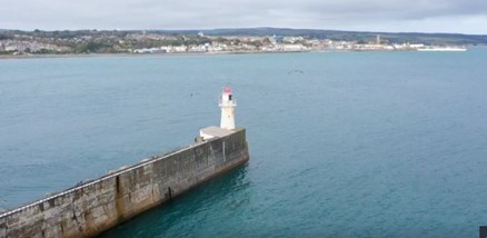
Last night’s BBC Countryfile programme took us to the Cornish town of Newlyn which houses, in an unassuming hut at the end of their pier, the fixed point (a brass bolt) that it used for the UK’s ‘sea level’. Amazingly this fixed point forms the base point for all ‘levelling measurements and the basepoint for UK maps!
The programme also features a historic tide gauge and explains how tidal measurements were taken here and the data they have provided makes up “the most complete sea level measurements in the world”. The Newyln tide gauge is part of the EA’s UK National Tide Gauge Network – a network of 43 tide gauges which are spread around the coasts of Britain. Learn about our role in servicing and and maintaining extremely important assets (read more).
Watch the full episode @ BBC iPlayer – Countryfile – Newlyn

View all Guides and insights

About Us

f 𝕏 in 📷

Services

  • Environmental Monitoring
  • Port-Log Data Platform
  • Marine Mapping
  • Spatial Data & GIS
  • Training Courses
  • Compliance
  • Asset Management System

Company

  • News & Projects
  • Events
  • Newsletters
  • About Us
  • Partners
  • Our Team
  • Sustainability and the Environment
  • Careers

Resources

  • Contact Us
  • Brochures, Data Sheets and Guides
  • Monitoring Support
  • Mapping Support
  • Case Studies

Newsletter

Subscribe to our newsletter for updates and exclusive content.

© 2025 Oceanwise. All rights reserved.

Privacy Policy | Terms of Service | Cookie Policy

© OceanWise 2024. OceanWise Limited is an independent company specialising in marine environmental data acquisition, management, publishing and GIS.
Registrar of Companies of England and Wales No. 7206926 and Companies Registration Office Ireland No. 641571.

Terms & Conditions | Privacy Notice | Contact Us

OceanWise HelpBot

Still need help?
This site uses cookies: Find out more.