• MONITORING
  • MAPPING
    • Home
    • About
      • About Us
      • Our Team
      • News & Views
      • Events
      • Sustainability and the Environment
      • Case Studies
      • Careers
      • Contact Us
    • Industries
      • Ports and Harbours
      • Maritime Pilotage
      • Bridges and Inland Waterways
      • Offshore Renewables
      • Governments and Agencies
      • Case Studies
    • Compliance
      • Compliance Overview
      • Marine Data Management
      • Asset Management System
      • Spatial Data Management & GIS
      • Our Courses
    • Training
      • Our Courses
      • Data Management
      • Data Management for Ports
      • Data Management, Governance and MEDIN toolset
      • Data Management and Marine Spatial Data Infrastructure (SDI)
      • Technical Training
    • Partners
      • Licenced Partners
      • Partner’s Resource Hub
    • Support
      • Resources
      • Support
      • Contact Us
banner

RSOBIA toolbar now available free of charge!

By Katie Edies 3rd February,2026

RSOBIA toolbar now available free of charge!

OceanWise Global > News & Projects > Uncategorised > RSOBIA toolbar now available free of charge!

OceanWise are pleased to announce that from the 1st of November 2021 the RSOBIA toolbar is available free of charge!

The software tool, which takes raster imagery and segments the data into geographic areas with similar statistical properties, has been particularly successful in supporting those working in research, development and education.

The tool’s creator Tim Le Bas and OceanWise Ltd, who have thoroughly enjoyed collaborating over the last few years on the sale of the tool, have decided that, whilst it will still be available and maintained, the tool will longer be sold as a commercial product. Instead, Tim Le Bas, will maintain and support the tool himself and offer free licences to those who request one.

For more details or to download your free tool, please contact Tim Les Bas on tlb@noc.ac.uk

Tim Le Bas comments: “I would like more people to have access to the tools, so removing all costs should allow new users to trial the tools and see how they can help their data processing and interpretation.”

What is RSOBIA?

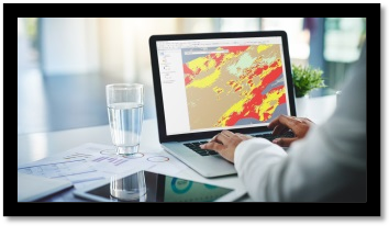
Remote Sensor Object Based Image Analysis or ‘RSOBIA’ is a software tool for Esri ArcMap, which interprets and digitises the areas and boundaries seen in imagery (such as sidescan sonar and multi-beam backscatter) and creates a polygonised map of the results (e.g. areas of similar seafloor type). It supports Segmentation and Classification – key techniques for image analysis, and gives quick, easy, repeatable results.

“I have found it (RSOBIA) straightforward to use. The software highlights similar areas of seabed in far greater detail than could be achieved by hand and can turn weeks of work into hours/days when used correctly“. Jon Evans, NOC

Will OceanWise still be involved with RSOBIA?

No, OceanWise will no longer be involved in the sale or support of the RSOBIA tool. As it will be a free tool, the distribution and maintenance of it will now be looked after solely by Tim Le Bas, the tool’s creator. We have loved being involved with the tool and hope to work with Tim in the future on other projects. OceanWise will of course support their existing customers with any transition required and resolve any outstanding queries.

View all Guides and insights

About Us

f 𝕏 in 📷

Services

  • Environmental Monitoring
  • Port-Log Data Platform
  • Marine Mapping
  • Spatial Data & GIS
  • Training Courses
  • Compliance
  • Asset Management System

Company

  • News & Projects
  • Events
  • Newsletters
  • About Us
  • Partners
  • Our Team
  • Sustainability and the Environment
  • Careers

Resources

  • Contact Us
  • Brochures, Data Sheets and Guides
  • Monitoring Support
  • Mapping Support
  • Case Studies

Newsletter

Subscribe to our newsletter for updates and exclusive content.

© 2025 Oceanwise. All rights reserved.

Privacy Policy | Terms of Service | Cookie Policy

© OceanWise 2024. OceanWise Limited is an independent company specialising in marine environmental data acquisition, management, publishing and GIS.
Registrar of Companies of England and Wales No. 7206926 and Companies Registration Office Ireland No. 641571.

Terms & Conditions | Privacy Notice | Contact Us

OceanWise HelpBot

Still need help?
This site uses cookies: Find out more.