• MONITORING
  • MAPPING
    • Home
    • About
      • About Us
      • Our Team
      • News & Views
      • Events
      • Sustainability and the Environment
      • Case Studies
      • Careers
      • Contact Us
    • Industries
      • Ports and Harbours
      • Maritime Pilotage
      • Bridges and Inland Waterways
      • Offshore Renewables
      • Governments and Agencies
      • Case Studies
    • Compliance
      • Compliance Overview
      • Marine Data Management
      • Asset Management System
      • Spatial Data Management & GIS
      • Our Courses
    • Training
      • Our Courses
      • Data Management
      • Data Management for Ports
      • Data Management, Governance and MEDIN toolset
      • Data Management and Marine Spatial Data Infrastructure (SDI)
      • Technical Training
    • Partners
      • Licenced Partners
      • Partner’s Resource Hub
    • Support
      • Resources
      • Support
      • Contact Us
banner

OceanWise support the UKHO in Exploring Anguilla’s marine environment through geospatial data

By Katie Edies 3rd February,2026

OceanWise support the UKHO in Exploring Anguilla’s marine environment through geospatial data

OceanWise Global > News & Projects > Uncategorised > OceanWise support the UKHO in Exploring Anguilla’s marine environment through geospatial data

Our team proudly undertook an installation recently for the UK Hydrographic Office (UKHO) in Anguilla, a British Overseas Territory in the Caribbean.

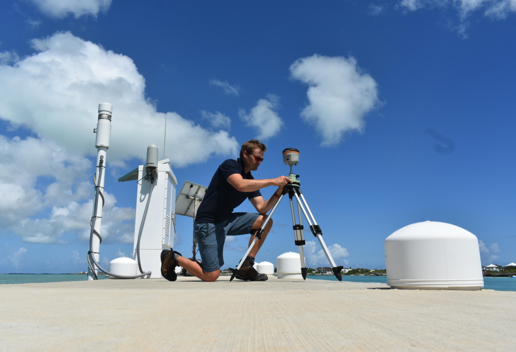
The successful trip formed part of the Marine Environmental Monitoring Systems (MEMS) – A 3-year Framework Agreement that OceanWise have been contracted to complete which includes sensor installations, provision of a data platform, shore control and GNSS surveys, as well as local training and mentoring.

The UKHO have now published an article titled “Exploring Anguilla’s marine environment through geospatial data” (June 2023) which explains in details the wider project in Anguilla and explores how the data that the project provides, supports safe navigation.

Extract taken from the article below:

β€œThe MEMS will provide real-time vertical movement of the sea level and meteorological data to support marine operations.

The MEMS data is linked to the UNESCO sea level station monitoring network, which provides real-time information on the operational status of global and regional networks of sea level stations. This gives the scientific community access to the Intergovernmental Coordination Group for the Tsunami and Other Coastal Hazards Warning System for the Caribbean and Adjacent Regions, which supports transnational challenges such as climate change and extreme weather events.”

OceanWise are very proud to be working on the MEMs project and with the UKHO supporting their work and the benefits that these improvements will bring for Anguilla, the UKHO and overseas territories.

Read the full UKHO article here

View all Guides and insights

About Us

f 𝕏 in πŸ“·

Services

  • Environmental Monitoring
  • Port-Log Data Platform
  • Marine Mapping
  • Spatial Data & GIS
  • Training Courses
  • Compliance
  • Asset Management System

Company

  • News & Projects
  • Events
  • Newsletters
  • About Us
  • Partners
  • Our Team
  • Sustainability and the Environment
  • Careers

Resources

  • Contact Us
  • Brochures, Data Sheets and Guides
  • Monitoring Support
  • Mapping Support
  • Case Studies

Newsletter

Subscribe to our newsletter for updates and exclusive content.

© 2025 Oceanwise. All rights reserved.

Privacy Policy | Terms of Service | Cookie Policy

Β© OceanWise 2024. OceanWise Limited is an independent company specialising in marine environmental data acquisition, management, publishing and GIS.
Registrar of Companies of England and Wales No. 7206926 and Companies Registration Office Ireland No. 641571.

Terms & Conditions | Privacy Notice | Contact Us

OceanWise HelpBot

Still need help?
This site uses cookies: Find out more.